Spatial Justice
- Global
- Continental
- National
- Regional
- Local
- Citizen
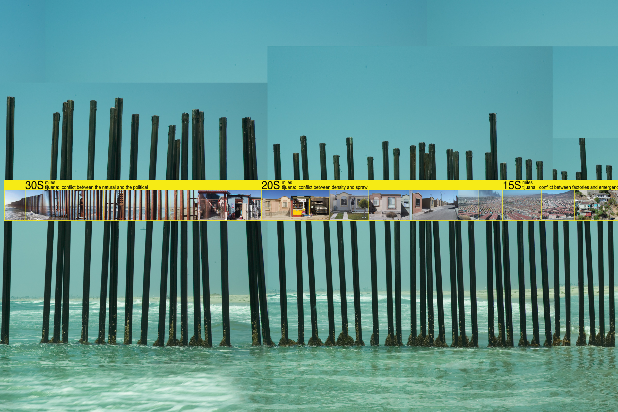
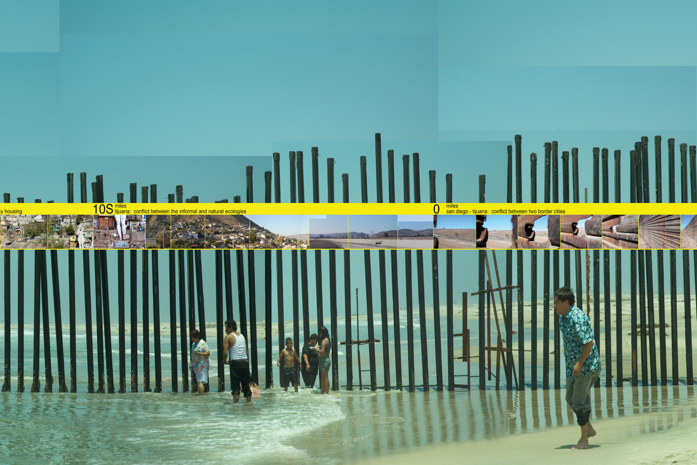
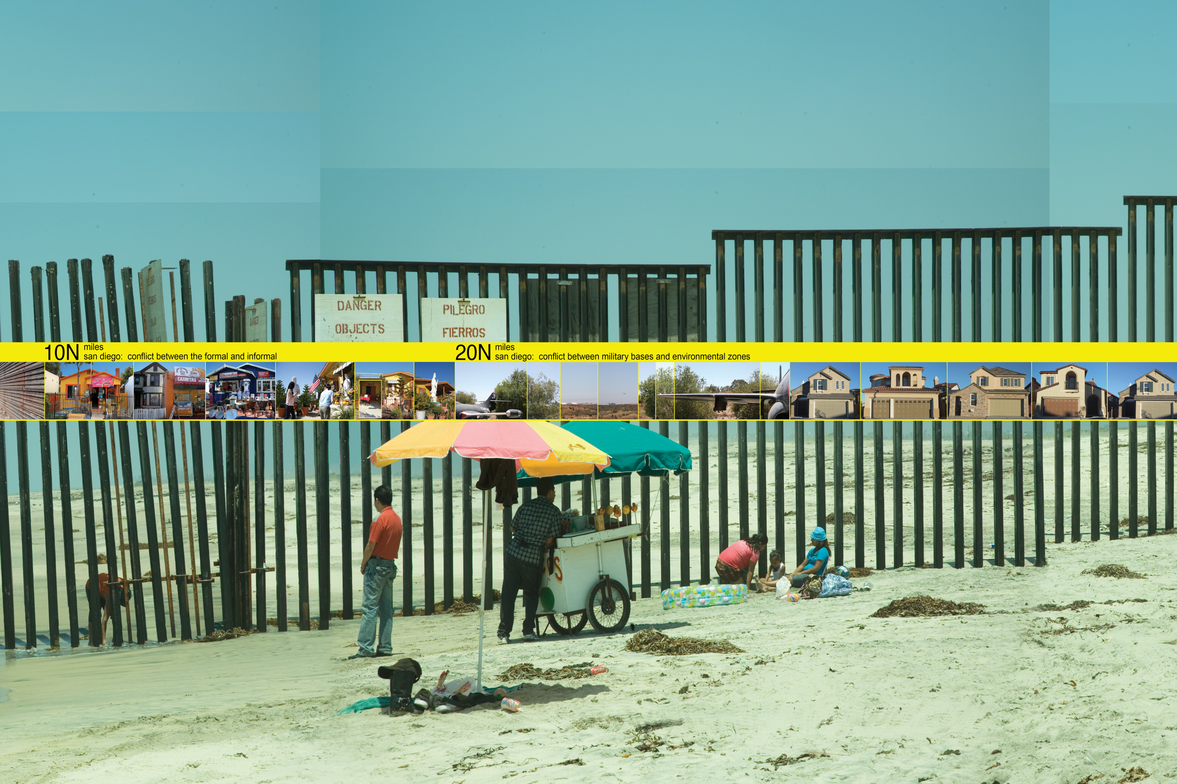
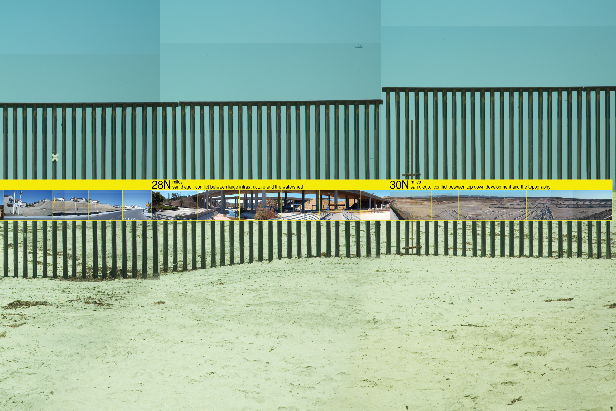
From this geography of conflict, where informal settlement, border wall, and estuary collide, we trace a geographic cross-section between these border cities to visualize how the border wall and its jurisdictional rigidity is reproduced inland. Along this “local equator” trajectory lie a sequence of urban collisions, critical junctures, between natural and artificial ecologies, top-down forces of urban development and bottom-up social and ecological systems. Our sixty-mile transborder cut begins thirty miles north of the border, at the periphery of San Diego, and descends sequentially southbound, ending with a thirty-mile dérive through Tijuana and its periphery.
The 60 Linear Miles of Cross-Border Conflict visual narrative was installed on the facade of the US Pavilion at the 2008 Venice Architecture Biennale, the very month the global economy collapsed and the Bush administration enforced its final wave of border securitization.