Spatial Justice
- Global
- Continental
- National
- Regional
- Local
- Citizen
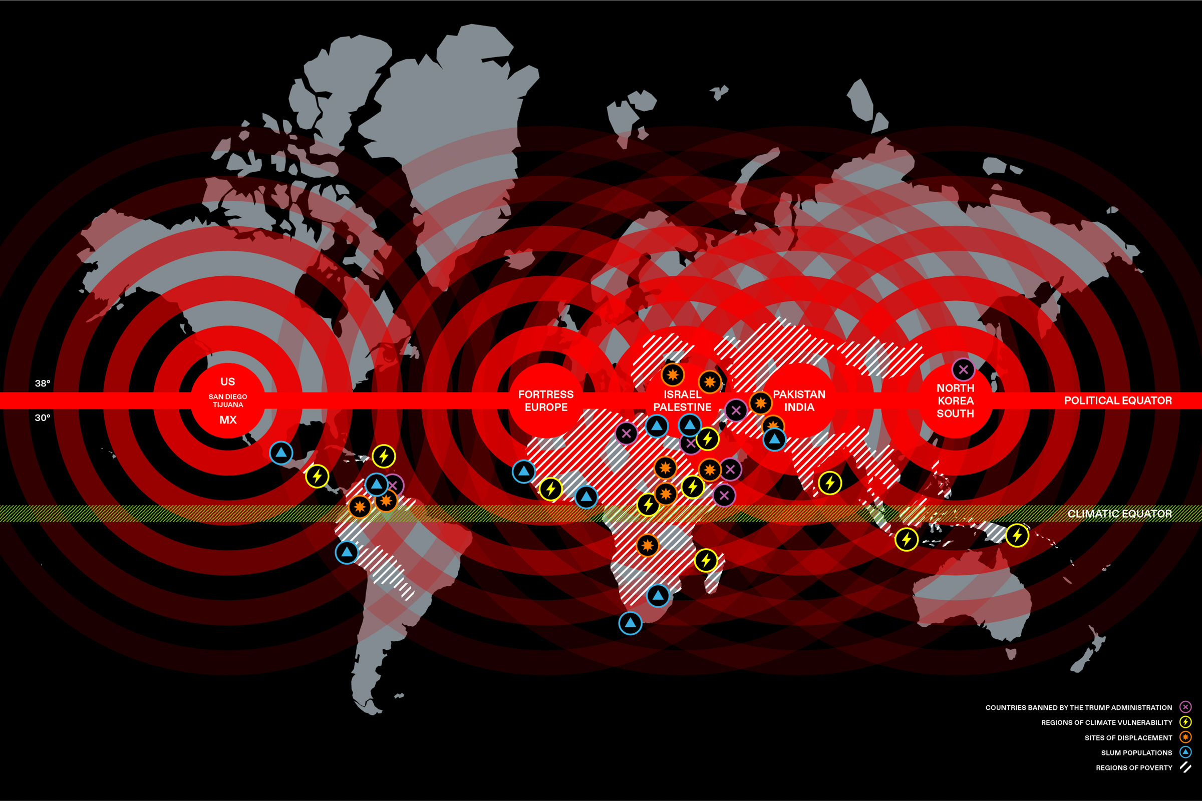
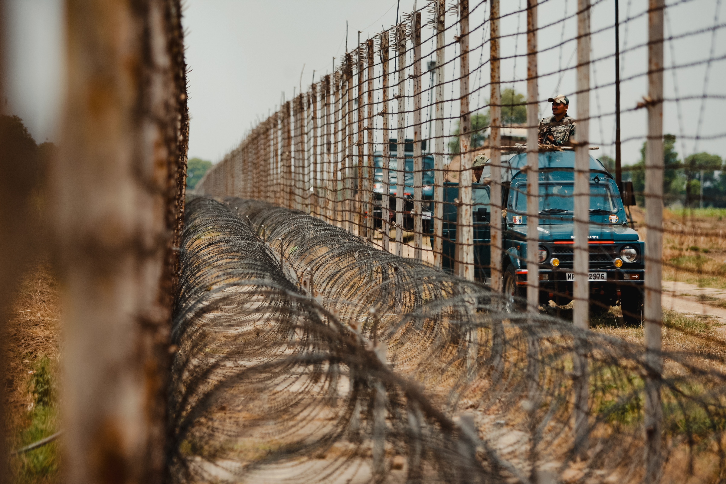
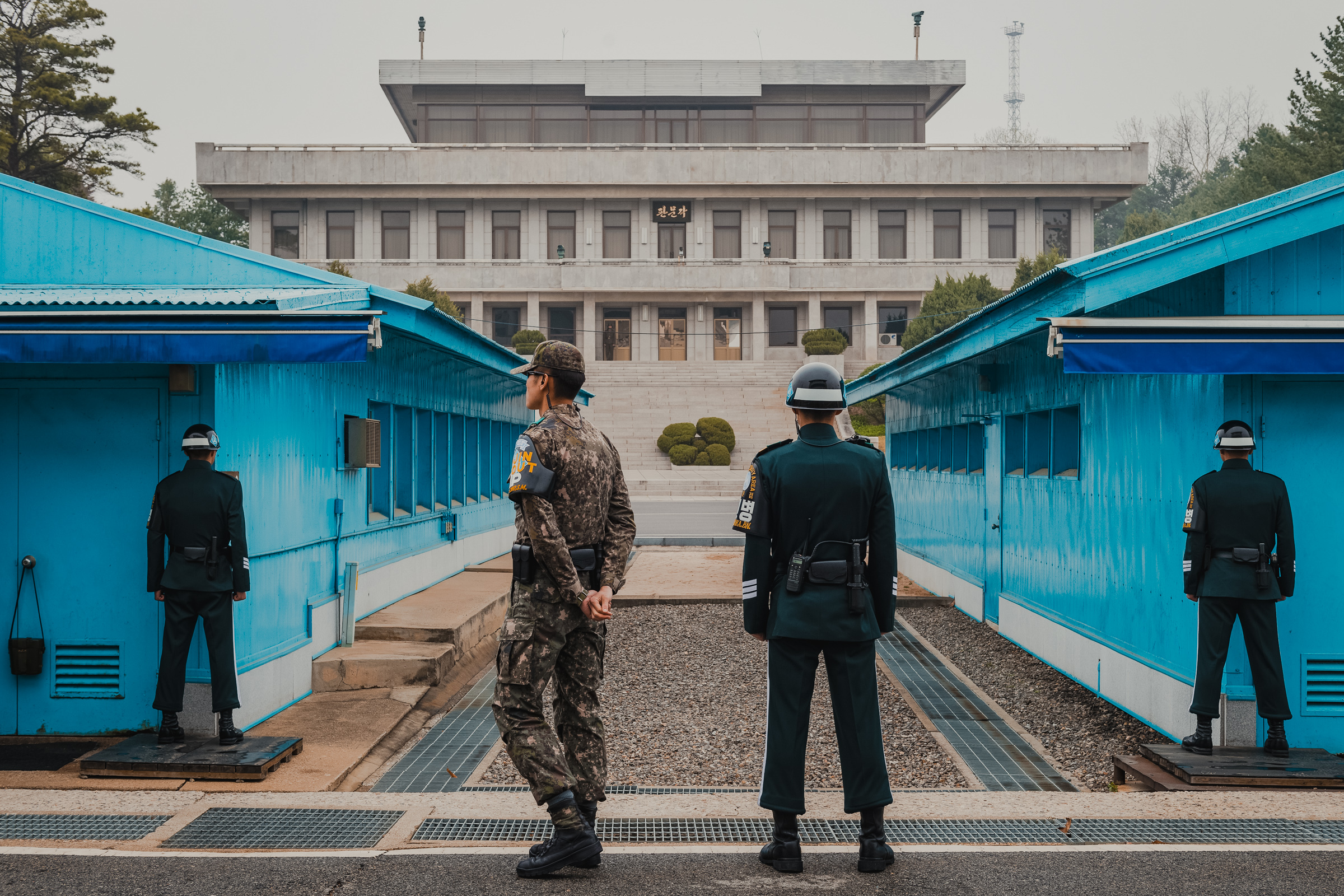
Extending a line from the San Diego–Tijuana border across a world atlas, between latitudes 30° and 38° north, we discover a corridor of a global conflict that links some of the world’s most contested border zones. Regions most affected by poverty, violence, accelerating climate vulnerability and migration are situated between the Political Equator and the Climatic Equator. The collision of nationalism, environmental crisis, political violence and human displacement is the great crisis of our age.
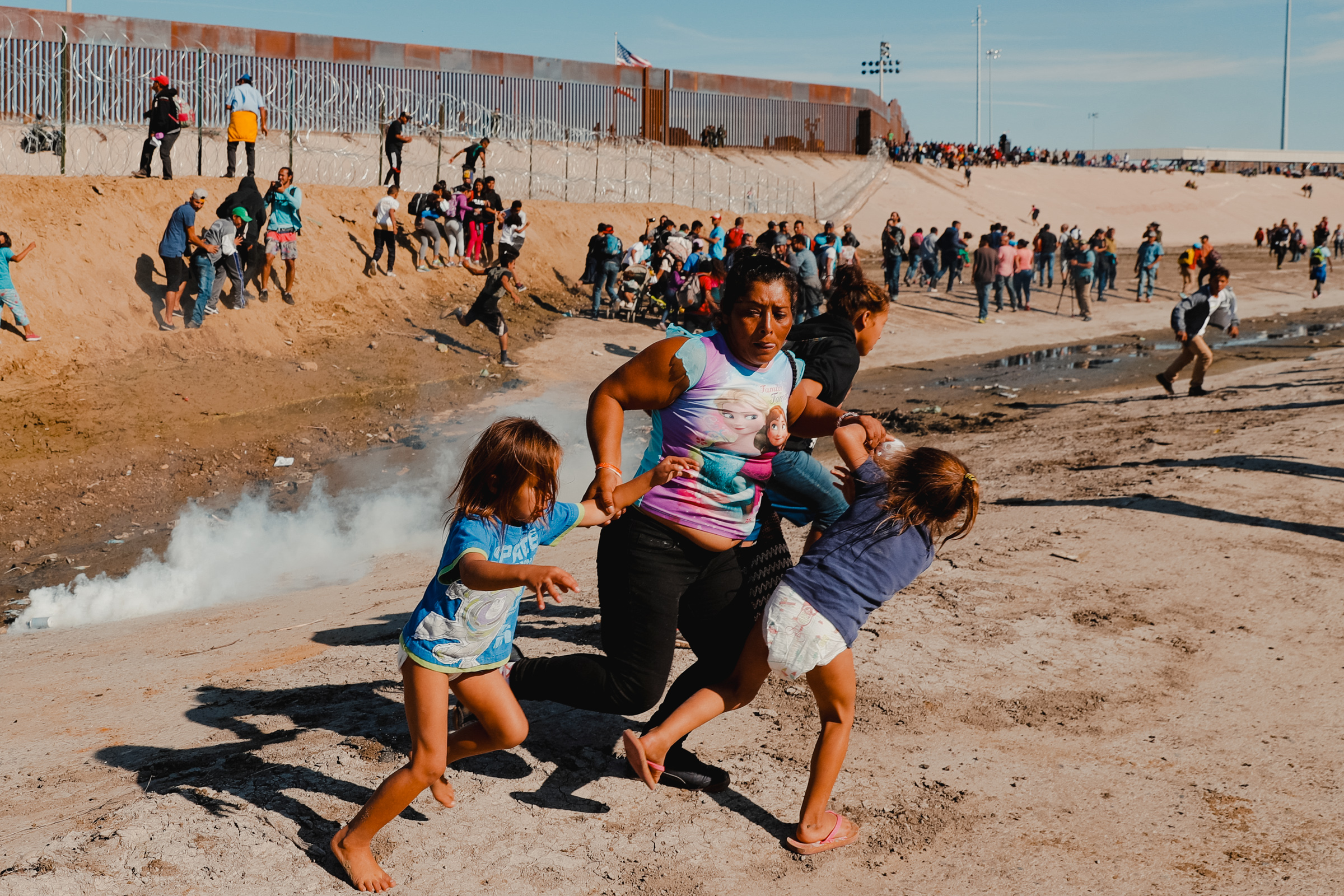
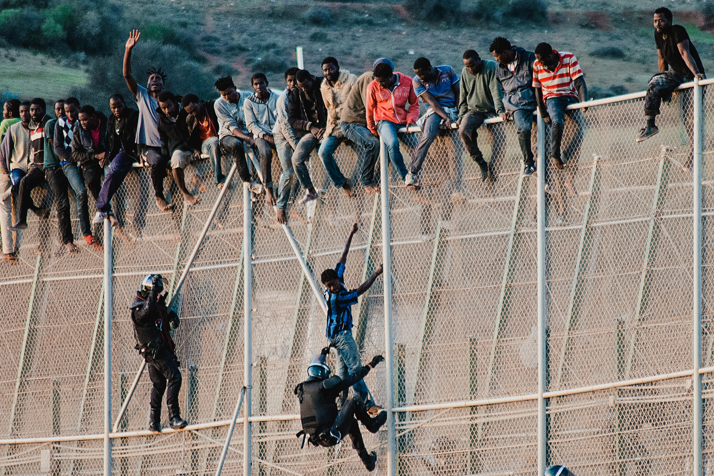
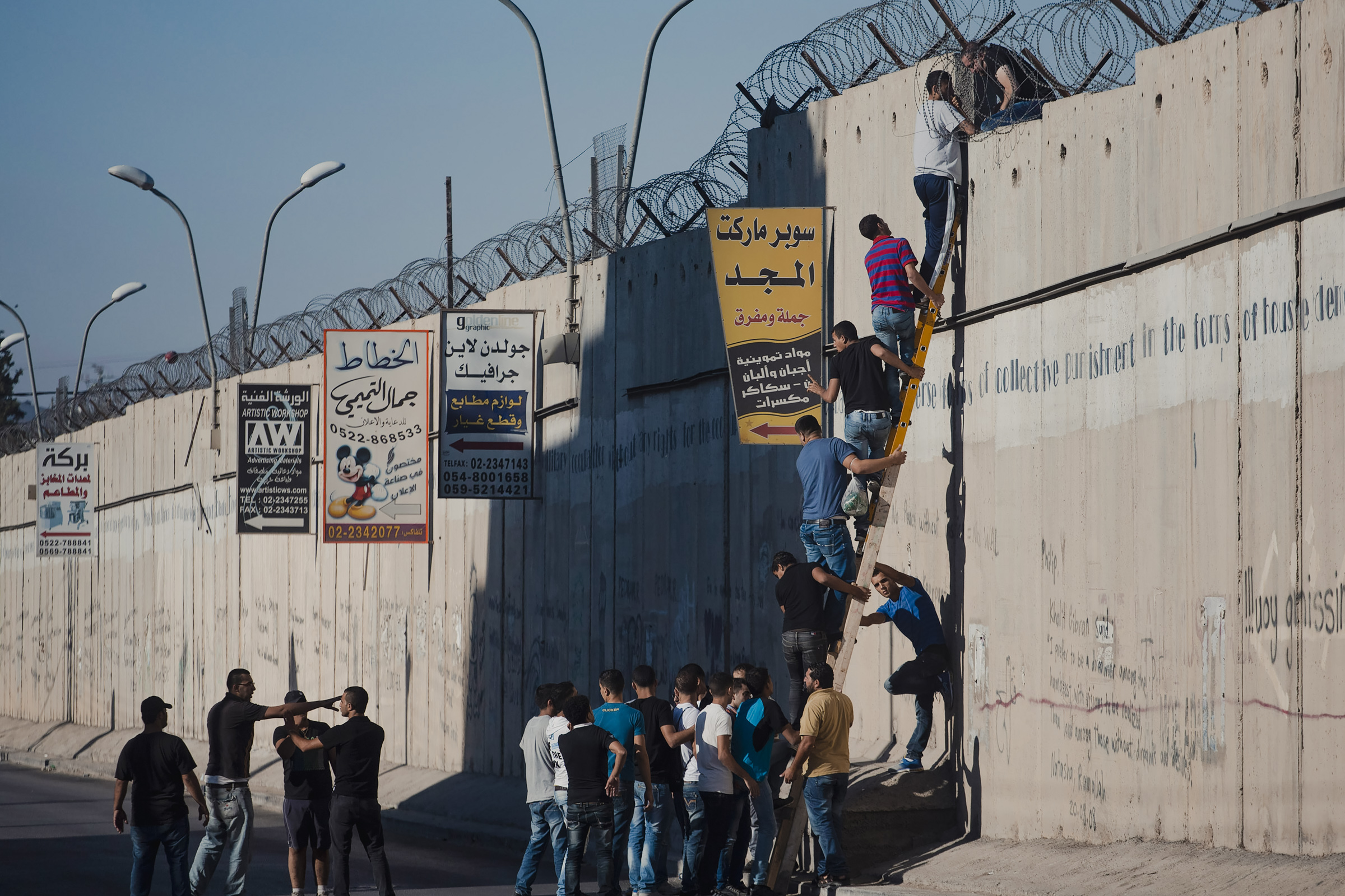
The Political Equator links San Diego–Tijuana, the most-trafficked international border checkpoint in the Western hemisphere, with the Strait of Gibraltar and the Mediterranean, where waves of migrants and refugees from North Africa and Syria flow across “Fortress Europe”; the Israeli-Palestinian border that divides the Middle East; the ongoing territorial conflict between Pakistan and India at Kashmir; and the border between North and South Korea, representing decades of intractable conflict and carrying Cold War tensions forward to the present day.